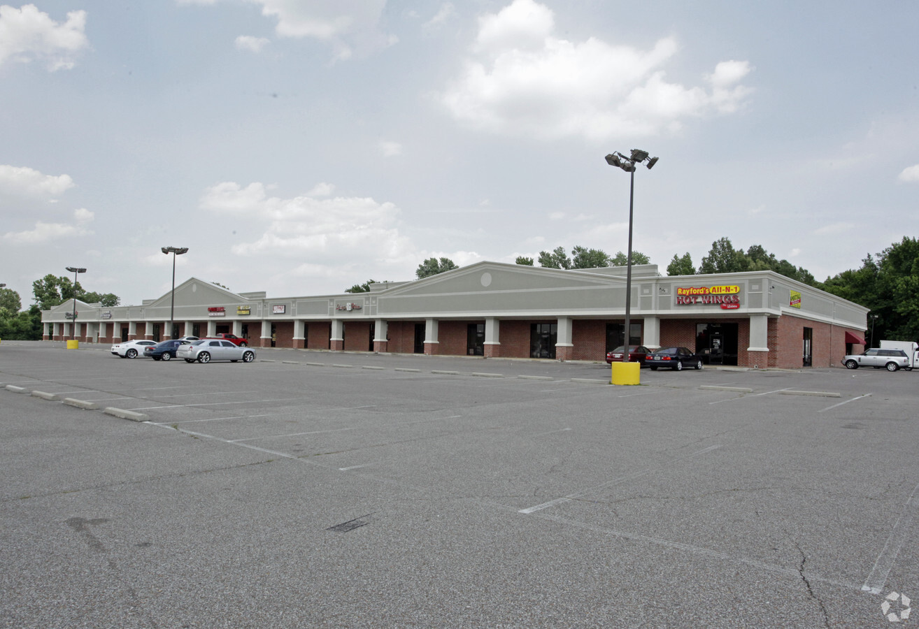
Property Record
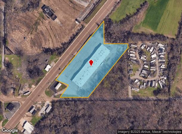
4250 S Highway 61 St, Memphis, TN 38109
NEARBY LISTINGS FOR SALE OR LEASE
Property Detail
4250 S Highway 61 St
Memphis, TN-MS-AR
Young Subdivision (Unrecorded)
07-5115-0-0013
NS WESTERN PARK DR SEE MAP T,S-3
Regionalshoppingcenterormallwithanchorstore
Shelby
X
Tennessee
05035C0475E
1,3,7-8
2023
6.81 AC
2024
South
022310
Memphis
53,724 SF
DEMOGRAPHICS near 4250 S Highway 61 St
1 Mile
3 Mile
5 Mile
2024 Total Population
6,064
43,740
108,634
2029 Population
5,948
43,192
109,904
Pop Growth 2024-2029
(1.91%)
(1.25%)
+ 1.17%
Average Age
39
40
39
2024 Total Households
2,274
16,576
41,735
HH Growth 2024-2029
(2.02%)
(1.37%)
+ 1.10%
Median Household Inc
$40,838
$40,461
$39,921
Avg Household Size
2.60
2.60
2.50
2024 Avg HH Vehicles
1.00
2.00
2.00
Median Home Value
$57,902
$75,341
$90,154
Median Year Built
1960
1963
1965
Nearby Places
- Restaurants
- Banks
- Shops
- Fitness
- Groceries
PUBLIC TRANSPORTATION
AIRPORT
Memphis International
DRIVE
WALK
Distance
Memphis International
15 min
6.9 mi
SALE & LEASE HISTORY
LISTING DATE
SALE/LEASE

Sep 25, 2016
For Lease
Sep 24, 2016
For Sale
Nearby Properties
Address
Land Use
TOTAL SIZE
Lot Size
Zoning
Address
Land Use
TOTAL SIZE
Lot Size
Zoning
438,763 SF
64.67 AC
IH
Address
Land Use
TOTAL SIZE
Lot Size
Zoning
1,009,363 SF
78.56 AC
EMP
Address
Land Use
TOTAL SIZE
Lot Size
Zoning
618.57 AC
CA
Address
Land Use
TOTAL SIZE
Lot Size
Zoning
2,569.30 AC
IH
Address
Land Use
TOTAL SIZE
Lot Size
Zoning
95,307 SF
25.91 AC
RU-3
Address
Land Use
TOTAL SIZE
Lot Size
Zoning
318,661 SF
26.92 AC
CMU-3
Address
Land Use
TOTAL SIZE
Lot Size
Zoning
79,658 SF
7 AC
RU-3
Address
Land Use
TOTAL SIZE
Lot Size
Zoning
79,340 SF
7 AC
RU-3
Address
Land Use
TOTAL SIZE
Lot Size
Zoning
43,476 SF
4.62 AC
CMU-3
Address
Land Use
TOTAL SIZE
Lot Size
Zoning
147,890 SF
16.92 AC
EMP
Address
Land Use
TOTAL SIZE
Lot Size
Zoning
54,000 SF
293.13 AC
IH
Address
Land Use
TOTAL SIZE
Lot Size
Zoning
233,060 SF
20 AC
EMP
Address
Land Use
TOTAL SIZE
Lot Size
Zoning
37,631 SF
3.38 AC
CMU-2
Address
Land Use
TOTAL SIZE
Lot Size
Zoning
142,333 SF
29.69 AC
CMU-3
Address
Land Use
TOTAL SIZE
Lot Size
Zoning
13,978 SF
7 AC
RU-3
Address
Land Use
TOTAL SIZE
Lot Size
Zoning
671.49 AC
IH
Address
Land Use
TOTAL SIZE
Lot Size
Zoning
12,789 SF
19.12 AC
RU-1
Address
Land Use
TOTAL SIZE
Lot Size
Zoning
370,000 SF
20.28 AC
EMP
Address
Land Use
TOTAL SIZE
Lot Size
Zoning
33,098 SF
39.07 AC
EMP
Address
Land Use
TOTAL SIZE
Lot Size
Zoning
22,408 SF
2.31 AC
CMU-1
Address
Land Use
TOTAL SIZE
Lot Size
Zoning
35,280 SF
5.80 AC
CMU-3
Address
Land Use
TOTAL SIZE
Lot Size
Zoning
128,704 SF
7.98 AC
RU-3
Address
Land Use
TOTAL SIZE
Lot Size
Zoning
91,965 SF
14.64 AC
RU-3
Address
Land Use
TOTAL SIZE
Lot Size
Zoning
27,084 SF
3.26 AC
CMU-1
Address
Land Use
TOTAL SIZE
Lot Size
Zoning
104,069 SF
12.50 AC
RU-3
Address
Land Use
TOTAL SIZE
Lot Size
Zoning
31,164 SF
3.08 AC
CMU-1
Address
Land Use
TOTAL SIZE
Lot Size
Zoning
8,568 SF
102.43 AC
R-6
Address
Land Use
TOTAL SIZE
Lot Size
Zoning
20.23 AC
IH
Address
Land Use
TOTAL SIZE
Lot Size
Zoning
23,860 SF
11.54 AC
R-6
Address
Land Use
TOTAL SIZE
Lot Size
Zoning
21,140 SF
7.53 AC
CMU-3
The World's #1 Commercial Real Estate Marketplace
Connect with us
© 2025 CoStar Group
The information above has been obtained from sources believed reliable. While we do not doubt its accuracy we have not verified it and make no guarantee, warranty or representation about it. It is your responsibility to independently confirm its accuracy and completeness. Any projections, opinions, assumptions, or estimates used are for example only and do not represent the current or future performance of the property. The value of this transaction to you depends on tax and other factors which should be evaluated by your tax, financial, and legal advisors. You and your advisors should conduct a careful, independent investigation of the property to determine to your satisfaction the suitability of the property for your needs.